Back to search results
 Print this page Print this page |
Aurukun Township and Access Road Agreement (ILUA) |
| Date: | 18 March 2003 | |
| Sub Category: | Indigenous Land Use Agreement (ILUA) (Native Title Act) |
| Place: | Aurukun, Cape York Peninsula |
|
| State/Country: | Queensland, Australia |
|
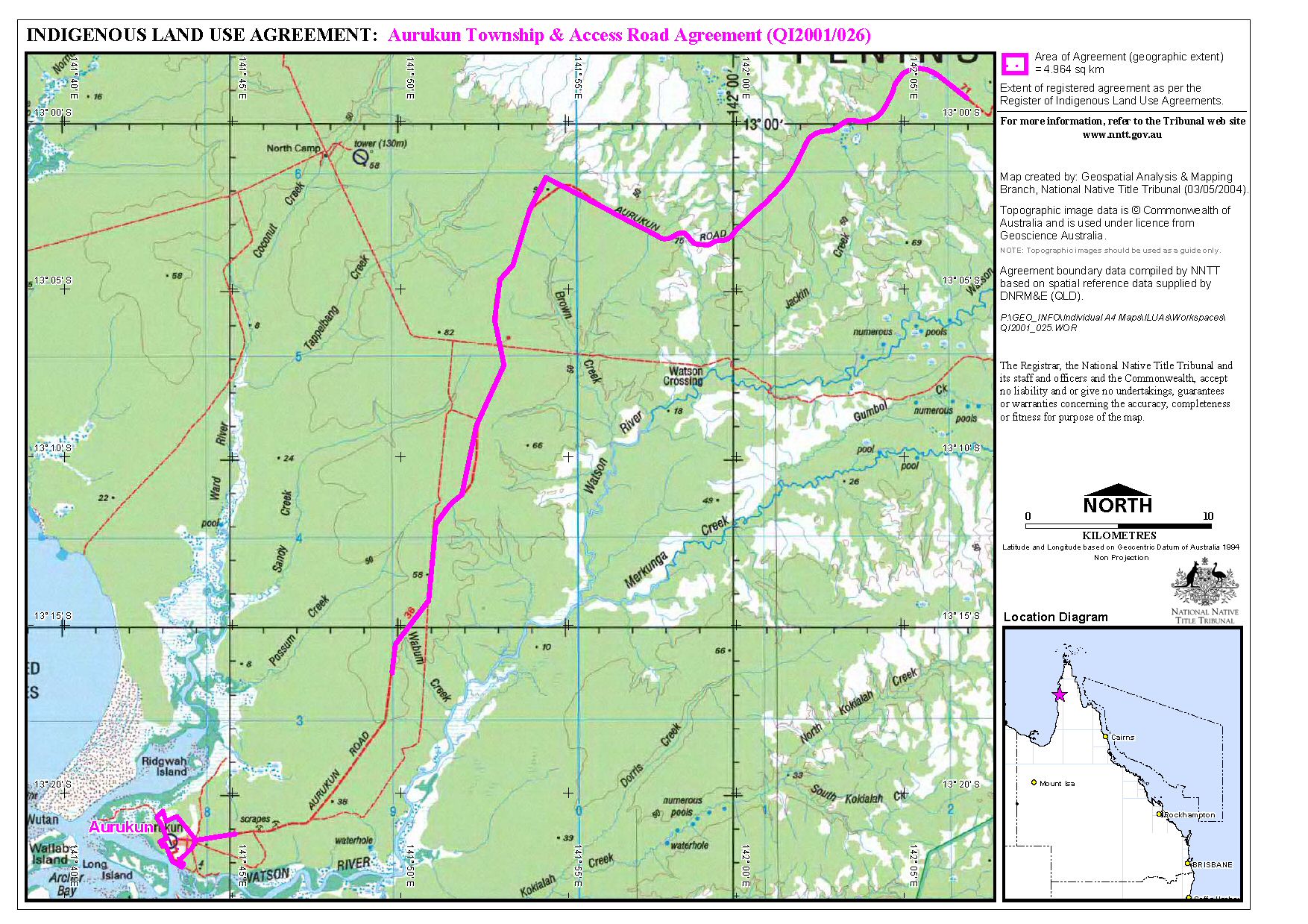
| The area of the ILUA is described in the Agreement in two parts: the land and waters in and around the township of Aurukun; and the land and waters included in the Aurukun Road Area. The Aurukun Road Area is defined as 'the land and waters comprising 15 metres either side of the centre alignment of that part of the present alignment of the Aurukun-Peninsula Development Road as is located in the Lease (Aboriginal Lands) No 1 dated 18 January 1979 comprising the land and waters in Lot 1 on Plan SC211, commencing at station 1 and continuing along its present alignment.' (See the map available via the Gallery link on this page).
Aurukun township is located in the middle of the west coast of the Cape York Peninsula in far north Queensland. The ILUA covers an area of 4.964 sq kms and is within the Aurukun Shire Council area and the Peninsula ATSIC region. |
| Legal Status: | Registered with the National Native Title Tribunal | |
| Legal Reference: | National Native Title Tribunal File No: QI01/26 | |
| Subject Matter: | Native Title | Native Title | | Future Act | Health and Community Services | Local Government | Native Title | Land Use |
| Summary Information: | |
The Aurukun Township and Access Road Indigenous Land Use Agreement (the ILUA) allows all future acts in and around the township of Aurukun to be done by the Aurukun Shire Council exempt from the right to negotiate process.
This will allow the Council to carry out works in future without needing to negotiate with the native title claimants, the Wik and Wik-Way People, about each activity. Activities include 'construction, enhancement, maintenance, operation, use [...] repair [...] or access' to public infrastructure, such as roads, reservoirs and drainage, and community works, such as community housing.
However, the Agreement does set out a process for the Council to notify and consult about activities that are to be done in the area of the township that is identified as the 'Undeveloped Area.' The extract from the Register of Indigenous Land Use Agreements explains that Schedule 2 of the ILUA 'comprises notification and consultation processes for future acts proposed to be done on undeveloped areas. The Schedule categorises Future Acts into Minor Future Works and Major Future Works outlining a consultation process for both.' |
Was this useful? Click here to fill in the ATNS survey

 Aurukun Township and Access Road Agreement (ILUA) Map - ( Image | Thumbnail | PDF)