
 Print this page Print this page | ||
Preminghana Indigenous Protected Area | ||
| Category: | Place | |
| Date: | 1 June 1999 | |
| Sub Category: | Indigenous Protected Area | |
| Place: | North-west coast | |
| Click this link to search this location with google maps | ||
| State/Country: | Tasmania, Australia | |
| Click this link to search this location with google maps | ||
| North-west coast of Tasmania. | ||
| Subject Matter: | Cultural Heritage | Environmental Heritage | Land Management | |
| Summary Information: | ||
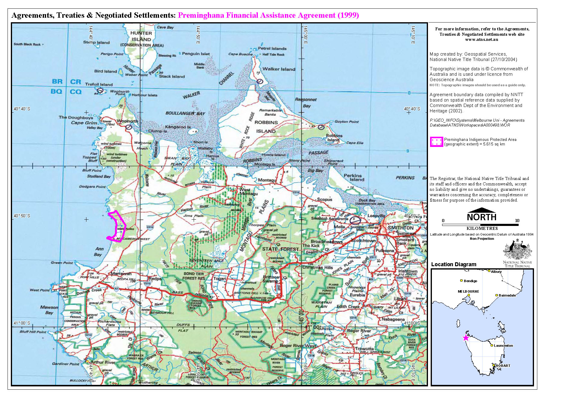
| Preminghana was declared an Indigenous Protected Area (IPA) in June 1999, under World Conservation Union (IUCN) Category VI. The IPA covers an area of 524 hectares and was one of the parcels of land returned to the Tasmanian Aboriginal community under the Aboriginal Lands Act 1995 (ALA). The land is managed by the Tasmanian Aboriginal Land Council (TALC). Section 32 of the ALA makes provision for the preparation of a Management Plan for returned land. The area has significant environmental and cultural features and is listed on the Register of the National Estate. | ||
| Detailed Information: | ||
| The Preminghana IPA is 524 hectares in size, being 5 kilometress long and 1 kilometre wide. Bordering the Indian Ocean, its most prominent feature is Mt Cameron West, a basalt plug which rises 168 metres above the coastal plain. The area consists of manuka thicket, tea-tree swamps, eucalyptus woodlands, poa and sedges with coast wattle and honeysuckle. The IPA falls within the Woolnorth Interim Biogeographic Region which means that controls on vegetation protection are highly desirable. It is on the Register of the National Estate as part of the 'Woolnorth Point to Marrawah Coastal Area' listing on account of the rare Tasmanian Skipper Butterfly. It also has an Aboriginal listing as the 'Mount Cameron West Engraving site'. The objectives in declaring an IPA were: These issues are reflected in the Management Plan for the IPA, which also covers the following issues: The Management Plan was drafted by TALC in 1997. Under the ALA community consultations were needed in order to endorse the plan, following which minor changes were made in 1998. TALC initially applied for funding in December 1997. Natural Heritage Trust (NHT) funding was granted for a caretaker's wages and a small amount for land management was given in the first year. Second and third year funding was conditional upon the area being declared an IPA. Apart from funding from the NHT, the IPA has attracted funding for infrastructure from the Aboriginal and Torres Strait Islander Commission (ATSIC) for a tractor for clearing gorse bush and from a large Tasmanian Corporation for fencing to prevent cattle grazing from neighbouring lands. Coastcare funds were utilised to develop the Management Plan and to commence rehabilitation works (eg coconut matting and jute mesh etc). | ||
Related Entries |
| Organisation |
| Event |
| Legislation |
| People |
| Policy/Strategy |
References |
| Resource |
| Environment Australia (Commonwealth Department of the Environment and Heritage) Indigenous Communities & the Environment. Indigenous Protected Areas: Preminghana Indigenous Protected Area |
Documents |
 Preminghana Financial Assistance Agreement Map - ( PDF | Thumbnail | Image) Preminghana Financial Assistance Agreement Map - ( PDF | Thumbnail | Image) |
 |
Glossary |
| Indigenous Protected Area (Australia) | Indigenous Protected Areas Programme (Australia) | Register of the National Estate (Australia) |
| ||||
| ||||
|
Was this useful? Click here to fill in the ATNS survey