
 Print this page Print this page | ||
Dhimurru Indigenous Protected Area | ||
| Category: | Place | |
| Date: | 1 December 2000 | |
| Sub Category: | Indigenous Protected Area | |
| Place: | North-east Arnhem Land, Northern Territory | |
| Click this link to search this location with google maps | ||
| State/Country: | Northern Territory, Australia | |
| Click this link to search this location with google maps | ||
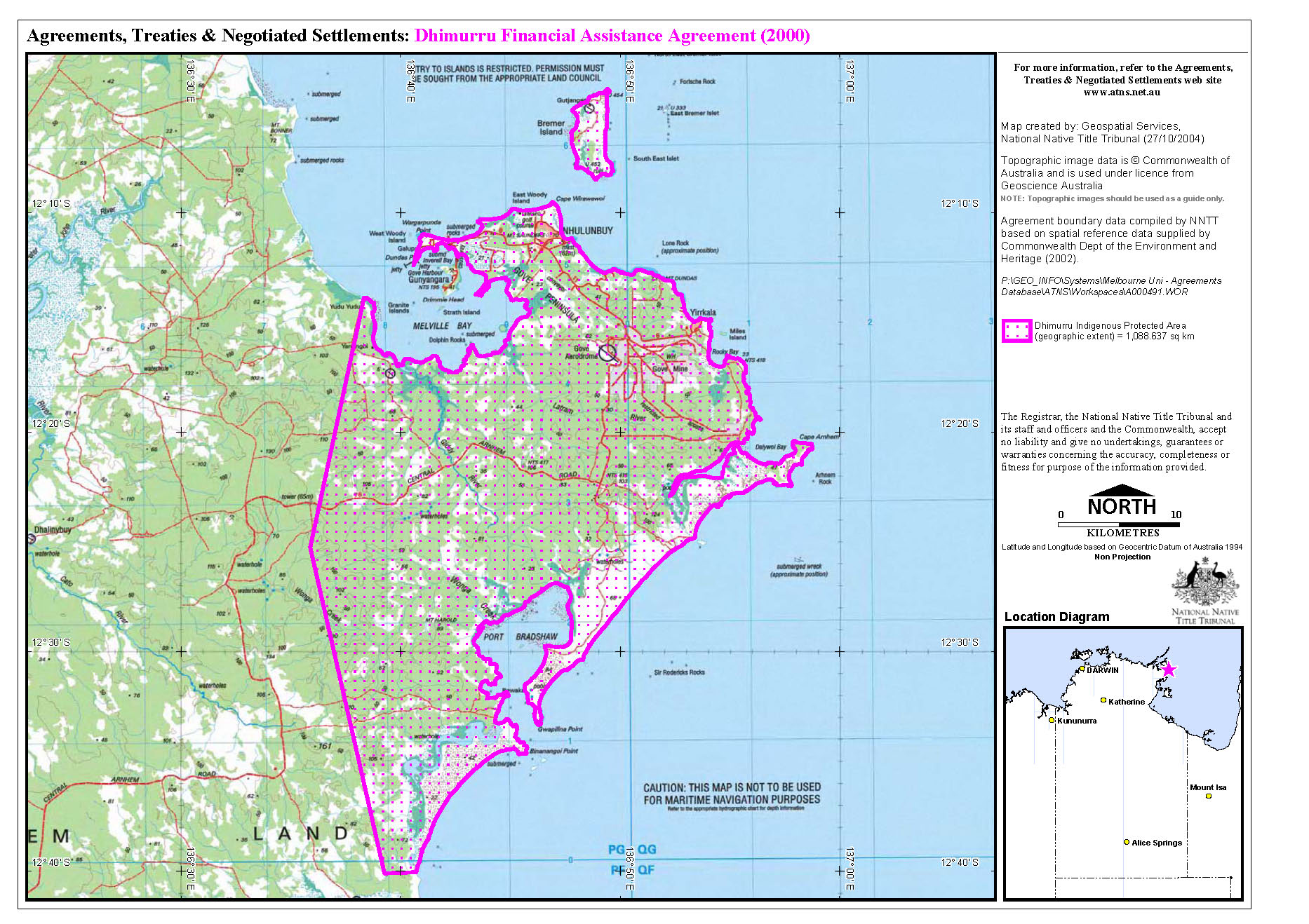
| According to the Plan of Management, the areas included in the IPA are those Aboriginal lands, to the low water mark, within a polygon bounded by the following WGS co-ordinates: E 689000 N 8673000; E 717000 N 8673000; E 717000 N 8597000; E 682000 N 8597000; E 670000 N 8624000. An estimate of the total land area is 92,080 hectares. This includes enclosed islands and rocks to the low water mark but excludes existing lease areas and the community areas of Yirrkala township and the Marrngarr Community Government Council area in the vicinity of Gunyanara. An estimate of the total marine area is 8,913 hectares. This incorporates marine areas which are bounded by the Nanydjaka (Cape Arnhem), Yalanbara (Port Bradshaw), Djuwalpawuy (Mount Dundas) and Dhambaliya (Bremer Island) Sacred Sites boundaries. | ||
| Subject Matter: | Environmental Heritage | Land Management | Research | |
| Summary Information: | ||
| The Dhimurru Indigenous Protected Area (IPA) was declared in December 2000 covering 8,500sqkm of land in North-east Arnhem Land. The area is managed by the Dhimurru Land Management Aboriginal Corporation on behalf of the Yolngu who are recognised as the traditional owners, under the Aboriginal Land Rights (Northern Territory) Act of 1976, of approximately 100,000 hectares of land in the region. | ||
| Detailed Information: | ||
| The Dhimurru Land Management Aboriginal Corporation was formed in 1992 to represent the interests of the 14 clan groups that have links to the Dhimurru lands. The IPA is a way of managing land that recognises Indigenous customary management and sustainable use as an effective approach to biodiversity conservation. Prior to making the decision to enter into the IPA arrangement, a comprehensive consultation process took place over 12 months before consensus was reached. The Plan of Management states: 'It is a first principle of the Yolngu decision that participation in an IPA arrangement will not diminish in any way their rights and responsibilities with respect to their lands.' The IPA has outstanding natural heritage values with high plant and animal diversity and species not found in protected areas elsewhere in the Northern Territory. It includes both land and sea country. The IPA also includes significant feeding and nesting habitat for sea birds and there are several threatened species of marine turtle within the area. Land management issues involve managing visitor access and rehabilitating damage from past uncontrolled access; wildlife protection; and research including monitoring the impact of marine debris on threatened turtle populations. Although the Traditional Owners set the management requirements and access arrangements throughout the IPA, there is an advisory body comprised of Environment Australia (the Commonwealth Department of the Environment and Heritage), the Northern Land Council, the Parks and Wildlife Commission of the Northern Territory and other bodies by invitation. Aboriginal rangers, graduates of Batchelor College in the Northern Territory, are employed within the IPA. | ||
Related Entries |
| Organisation |
| Event |
| People |
| Policy/Strategy |
References |
| Resource |
| Environment Australia (Commonwealth Department of the Environment and Heritage) Indigenous Communities and the Environment Fact Sheets: Dhimurru |
Documents |
 Dhimurru Financial Assistance Agreement Map - ( Image | Thumbnail | PDF) Dhimurru Financial Assistance Agreement Map - ( Image | Thumbnail | PDF) |
 |
Glossary |
| Indigenous Protected Area (Australia) | Indigenous Protected Areas Programme (Australia) |
| ||||
| ||||
|
Was this useful? Click here to fill in the ATNS survey